Glen Aulin Trip - Sue & Allyn - July 2008
| Introduction |
| Day 1 |
| Day 2 |
| Day 3 |
| Photo Album |
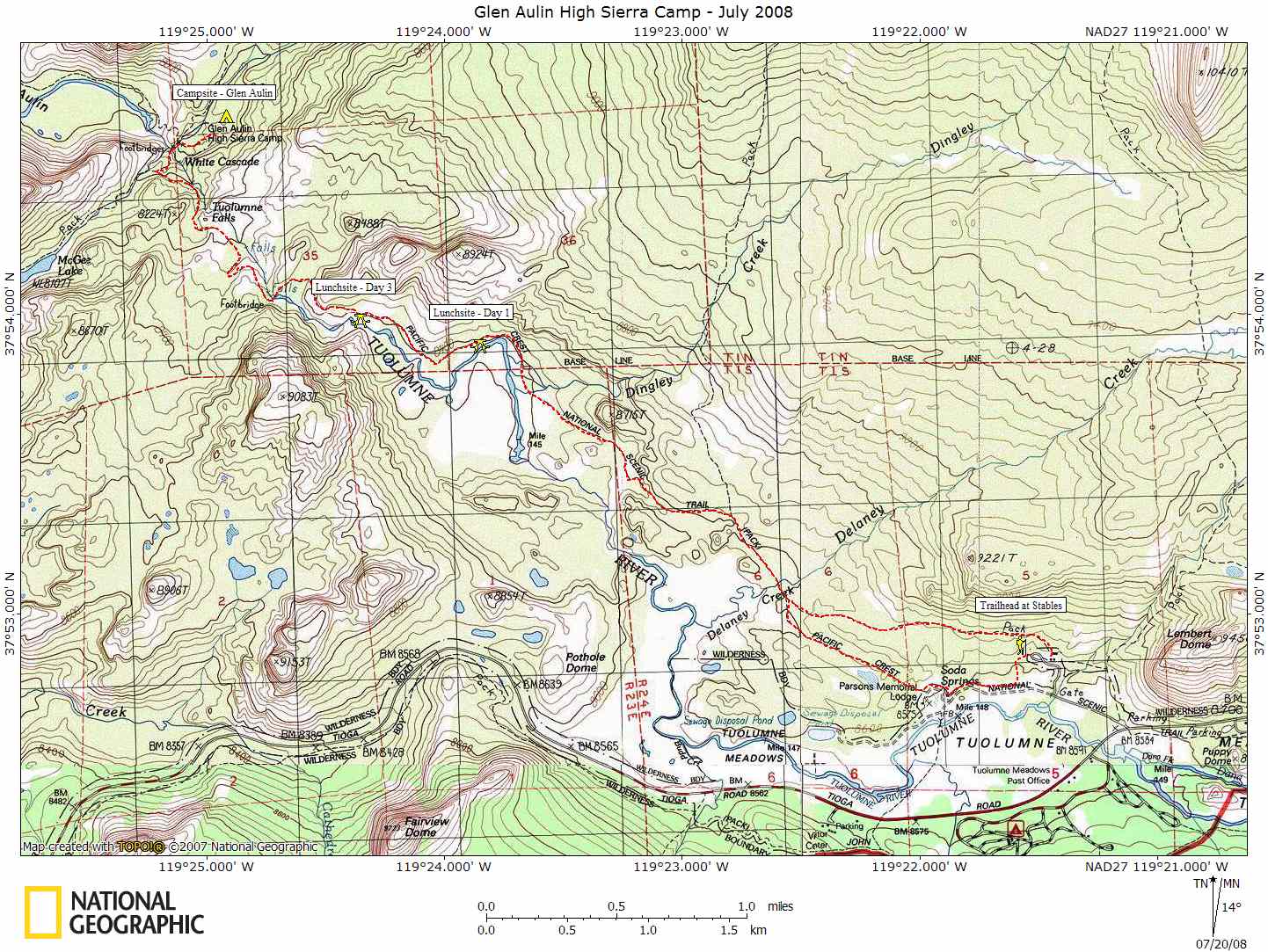
| Map |
| NG Topo Map |
Introduction
This journal describes the backpacking trip Sue and I took in July of 2008 to the Glen Aulin area out of Tuolumne Meadows. A map of our trip can be seen by clicking on the link above or you can download a NG Topo copy of the map if you have National Geographic's Topo software. Our trip was down the Tuolumne River canyon, which we thought would be a nice and not so easy hike for the two us. We had planned on this to be a two night stay with the middle day a layover to see the waterfalls and do some fishing.
We had never been down the canyon or to Glen Aulin and thought it would be a nice trip. The weather was holding up nice but there were a lot of fires in the area so we set out to give this trip a try. You can read about the trip or look at the photo albums by clicking on the links above.
Weather
Las Vegas, NV
Sawmill Mountain
Groveland, CA
Yosemite Natl Park
.Clearlake, CA