May Lake Overnight - Sue & Allyn - July 2007
| Introduction |
| Day 1 |
| Day 2 |
| Photo Album |
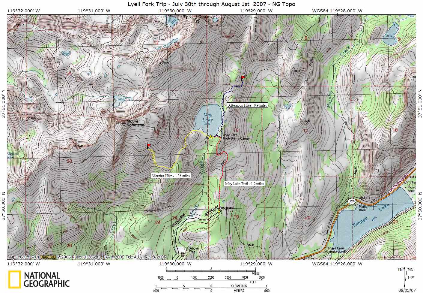
| Map |
| NG Topo Map |
Introduction
This journal describes the backpacking trip my wife and I took to May Lake in July of 2007. A map of our trip can be seen by clicking on the link above or you can download a NG Topo copy of the map if you have National Geographic's Topo software. Our trip was up to May Lake where we stayed at the backpackers camp near the south end of the lake by the High Sierra Camp. We had originally planned to do an overnight trip down Yosemite Creek, but the creek had dried up the week before and we were concerned about having any water to drink along the way. Besides, the best part of that trip is seeing the falls up close. So maybe next year if the weather cooperates!
We decided to do an overnighter to May Lake as if was a easy hike and although probably better considered a day hike, we figured it would give us a chance to do some nice day hikes around the lakes. In the 50 plus years I have been in Yosemite National Park I had never been to May Lake. What a hidden secret. The lake is beautiful and Mt. Hoffman keeping watch over the lake makes for some really nice pictures. We had not planned on staying at the backpackers camp but we found a nice spot on the edge of the campground on the west side and it had a great view of the lake on top of the little knoll we were on. Although it got quite crowded at night, it was much better than some of the campgrounds were have car camped at. Not sure if taking the wife to a place with running water and flush toilets was a good idea for future trips though!
Weather
Las Vegas, NV
Sawmill Mountain
Groveland, CA
Yosemite Natl Park
.Clearlake, CA